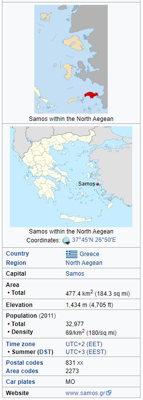
Location and information
Geography
The area of the island is 477.395 km2 (184.3 sq mi), and it is 43 km (27 mi) long and 13 km wide. It is separated from Anatolia by the approximately 1-mile-wide (1.6 km) Mycale Strait. While largely mountainous, Samos has several relatively large and fertile plains.
A great portion of the island is covered with vineyards, from which muscat wine is made. The most important plains except the capital, Vathy, in the northeast, are that of Karlovasi, in the northwest, Pythagoreio, in the southeast, and Marathokampos in the southwest. The island's population is 33,814, which is the 9th most populous of the Greek islands. The Samian climate is typically Mediterranean, with mild rainy winters, and warm rainless summers.
Samos' relief is dominated by two large mountains, Ampelos and Kerkis (anc. Kerketeus). The Ampelos massif (colloquially referred to as "Karvounis") is the larger of the two and occupies the center of the island, rising to 1,095 metres (3,593 ft). Mt. Kerkis, though smaller in area, is the taller of the two, and its summit is the island's highest point, at 1,434 metres (4,705 ft). The mountains are a continuation of the Mycale range on the Anatolian mainland.


